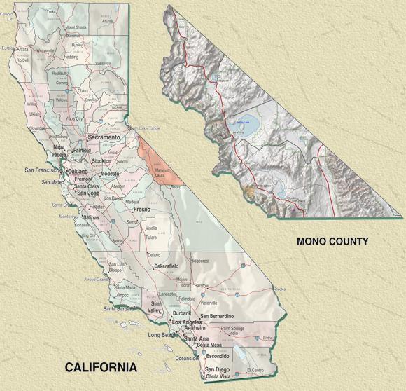
Mono County borders the east side of Yosemite National Park and several Wilderness Areas in the High Sierra. It is 104 miles long and from 40 to 50 miles wide, encompassing some 3,018 square miles - 2.3 million acres (the 18th largest of California's 58 counties).
The County's area is marked by the startling contrast between its eastern and western boundaries. Bounded on the west by the Sierra Nevada crest, this region is characterized by its mountains, lakes, streams and forests.
Unlike the gentle, rolling escarpment west of the crest, the eastern slope of the Sierra plunges dramatically to the valley floors. Much of it is wilderness from 7,000 feet to 13,000 feet elevation.
The eastern boundary (and, in fact, the easternmost section of the county, which is approximately two-thirds of its width) is actually the westernmost edge of the Great Basin.
It's a magnificent high-desert region of volcanic tablelands, plains of piñon and sage, and perhaps one of the most interesting and studied inland seas in North America -- Mono Lake (the name Mono comes from a Yokut Native American word meaning "flies," referring to the brine fly which inhabits the shores of Mono Lake.)
More information about Mono Lake is available at the Mono Lake Committee.
This stark counterpoint between mountain and desert ecosystems makes Mono County both an intriguing and challenging place to live. Indeed, the most appropriate catchword for Mono County may be "contrast" -- black obsidian juxtaposes white granite; densely forested slopes tower above sagebrush flatlands; and cool mountain streams merge with steaming hot springs.
All of this makes Mono County a fantastic recreation area ... and results in about 30-50 search and rescue missions every year.
For more information about Mono County visit the Mono County - California's Eastern High Sierra web site and check the links on our Links page.
Mono County has a volcanic history. Check these United States Geological Survey fact sheets:
You can checkout the latest earthquake activity at Long Valley Region Earthquakes
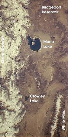
NASA Space Shuttle picture of Mono County area
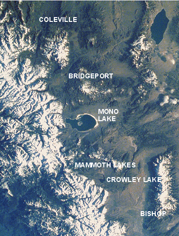
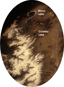
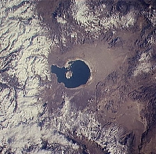
These are some NASA satellite and space shuttle views of Mono County and Mono Lake. The top of each photo is northerly but they are not perfectly aligned north and south. Click on each picture for larger views.
Portion of NASA Photo STS059-219
showing the Sierra Nevada and Mono Lake
... much of the view is Mono County
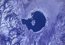
Portion of NASA Photo STS062-98-160
showing Mono Lake
Portion of NASA Photo STS068-168-7A
showing the Sierra Nevada and Mono County
from Bridgeport south
Portion of NASA Photo STS042-4-26
showing Mono Lake