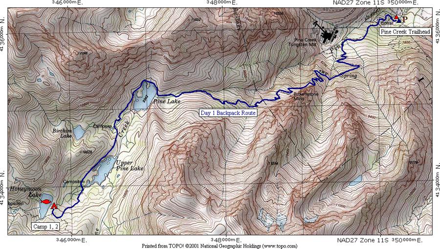
This map shows the first day's route from the trailhead at the end of the road on Pine Creek to Honeymoon Lake. The CAMP 1, 2 legend indicates the group will spend two nights here. The tent symbol signifies their campsite and the fish symbol indicates that fishing is available here. Note that the route is colored blue to distinguish it from the route for other days.
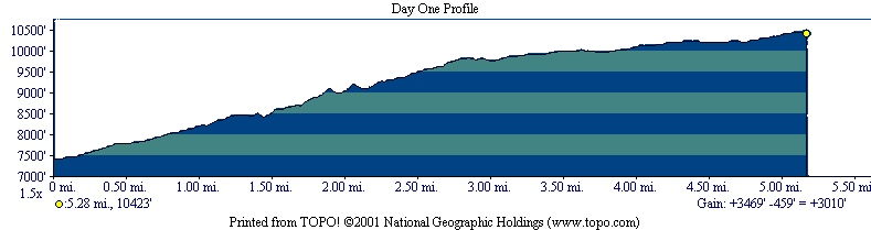
The profile shows that the hike is 5.28 miles long, starts at 7,413 feet elevation, gains 3,469 feet, loses 459 feet for a net gain of 3,010 feet to end at 10,423 feet elevation. In the TOPO! program you can move the yellow dot shown in the upper right to any position on the route to determine the elevation and distance from the start.
| Map Home | Day 1 | Day 2 | Day 3 | Day 4 | Day 5 | Day 6 | Day 7 | Day 8 |