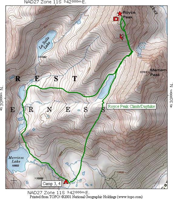
The fourth day's route in green shows a day hike from [CAMP 3, 4] to the top of Royce Peak with fine views for picture taking and then back to camp by way of the Merriam Lakes basin.
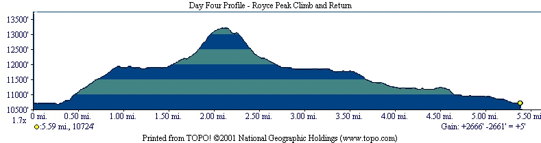
The profile shows that the hike is 5.59 miles long. The climb from camp to the lake basin is fairly steep, then you see the flat hike around the lake, then the fairly steep climb to the top of Royce Peak which is 2,666 feet higher than the campsite.
You will note that the profile indicates you have a net gain of 5 feet for the day ... how can that be since you returned to the same place you started from? It's an example of the small errors that occur because when drawing the route, the cursor wasn't brought back to the exact same spot. This points out the fact that there will always be small errors in this type of information, just like the fact that your GPS receiver will give you small errors in position and fairly large errors in elevation.
| Map Home | Day 1 | Day 2 | Day 3 | Day 4 | Day 5 | Day 6 | Day 7 | Day 8 |