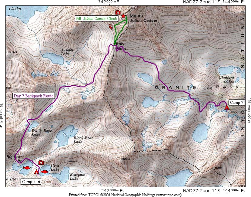
This map shows the seventh day's route in purple from [CAMP 5, 6] over Italy Pass to [CAMP 7]. From Italy Pass there is a side hike in green to the top of Mount Julius Caesar.
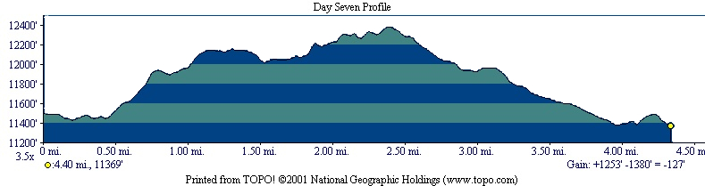
The profile shows that the hike is 4.40 miles long, starts at 11,496 feet elevation, gains 1.253 feet, loses 1,380 feet for a net loss of 127 feet to end at 11,369 feet elevation. You will notice a relatively steep section shortly after leaving camp. The flat areas where the route passes a lake are evident. It crosses Italy Pass at 12,383 feet elevation. Mount Julius Caesar can be climbed from the pass as shown below.
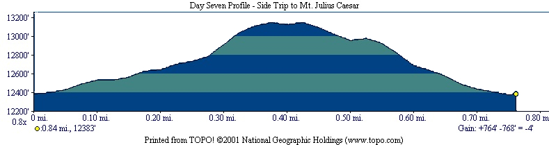
The profile shows that the round trip to Mount Julius Caesar is .84 miles long with a gain of 764 feet from the pass to the peak. Again there is an error showing a net loss of 4 feet as explained earlier.
| Map Home | Day 1 | Day 2 | Day 3 | Day 4 | Day 5 | Day 6 | Day 7 | Day 8 |