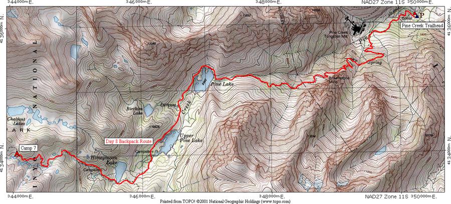
This map shows the eighth day's route from [CAMP 7] to the trailhead at Pine Creek.

The profile shows that the hike is 6.64 miles long, starts at 11,369 feet elevation, gains 590 feet, loses 4,541 feet for a net loss of 3,951 feet to end at 7,418 feet elevation.
Hope you enjoyed the trip.
| Map Home | Day 1 | Day 2 | Day 3 | Day 4 | Day 5 | Day 6 | Day 7 | Day 8 |