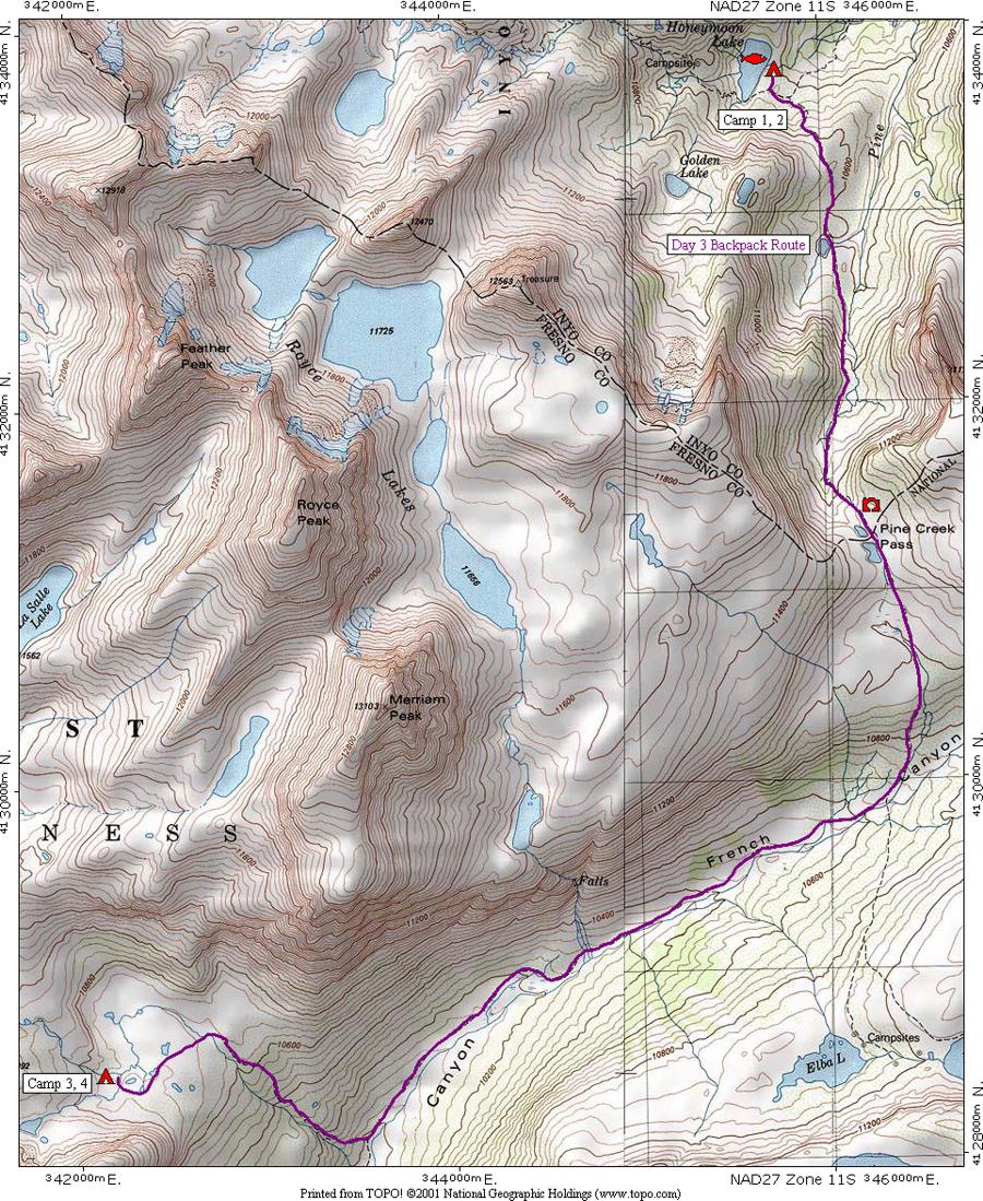
This reduced size map shows the third day's route in purple from [CAMP 1, 2] at Honeymoon Lake over Pine Creek Pass where there are great views for picture taking, down French Canyon, then up to a meadow below Merriam Lake to [CAMP 3, 4] where the group will spend two nights here.
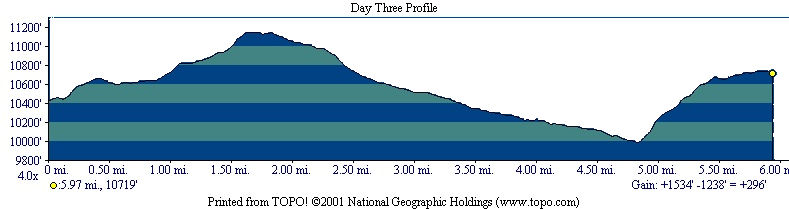
The profile shows that the hike is 5.97 miles long, starts at 10,423 feet elevation, gains 1,534 feet, loses 1,238 feet for a net gain of 296 feet to end at 10,719 feet elevation. The route crosses 11,146 foot Pine Creek Pass. The climb out of French Canyon to camp is fairly steep.
| Map Home | Day 1 | Day 2 | Day 3 | Day 4 | Day 5 | Day 6 | Day 7 | Day 8 |