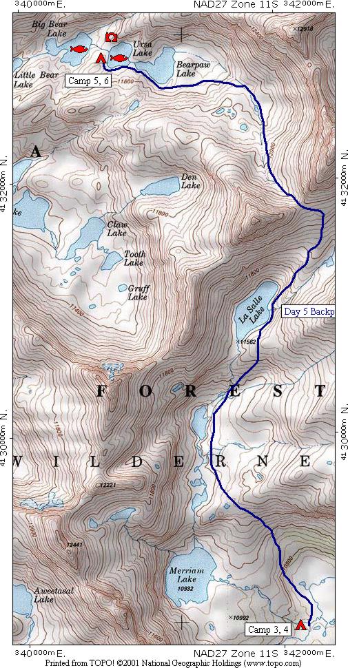
The fifth days route in blue leads from [CAMP 3, 4] up through the upper Merriam Lakes basin, past La Salle Lake, then over a cross country pass into the bear lakes area to [CAMP 5, 6] at Ursa Lake. You will note that the route stays to the east of Merriam Lake when leaving camp ... to follow slightly easier terrain avoiding the steeper climb at the head of Merriam Lake which had been seen on the day hike the day before.
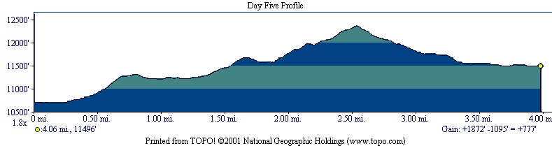
The profile shows that the hike is 4.06 miles long, starts at 10,719 feet elevation, gains 1,872 feet, loses 1,095 feet for a net gain of 777 feet to end at 11,496 feet elevation. You can spot the flat areas where the route goes alongside the lakes and can see that their is no really steep climbing.
| Map Home | Day 1 | Day 2 | Day 3 | Day 4 | Day 5 | Day 6 | Day 7 | Day 8 |