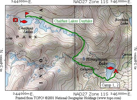
This map shows the second day's day hike route in green from camp at Honeymoon Lake to the Chalfant Lakes. The fish and camera symbols indicate fishing and picture taking are available at the lakes.
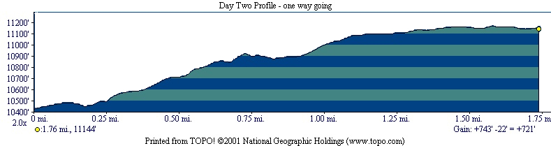
The profile shows that the hike (one way) is 1.76 miles long, starts at 10,423 feet elevation, gains 743 feet, loses 22 feet for a net gain of 721 feet to the Chalfant Lakes at 11,144 feet elevation. The hike back to camp would be the reverse of that for a total of 3.52 miles.
| Map Home | Day 1 | Day 2 | Day 3 | Day 4 | Day 5 | Day 6 | Day 7 | Day 8 |